By Staff Reporter
ISLAMABAD: A sharp rise in the River Jhelum’s water level sent residents of Muzaffarabad scrambling to higher ground on Saturday, as fears mounted that India’s suspension of the Indus Waters Treaty had triggered deliberate flooding downstream.
Pakistani officials attribute the surge to seasonal snowmelt, but the timing — days after India’s dramatic move—has deepened distrust in a region where water is both a lifeline and a flashpoint.
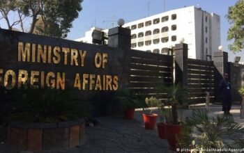
India suspended the Indus Waters Treaty on Monday, a 64-year-old pact brokered by the World Bank that divides the Indus River system’s waters between the two nations. The decision, announced by India’s foreign ministry, cited “fundamental changes in circumstances” and “persistent cross-border terrorism” from Pakistan as justification.
It followed a militant attack in Indian-administered Kashmir last week that killed 26 tourists, an incident New Delhi blames on Islamabad—a charge Pakistan rejects outright.
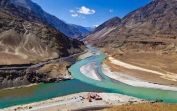
The treaty assigns the eastern rivers—Ravi, Beas, and Sutlej—to India, while Pakistan relies on the western rivers—Indus, Jhelum, and Chenab—for over 80 percent of its agricultural water. For decades, it has held firm through wars and crises, but India’s suspension marks a stark escalation.
Pakistan’s foreign ministry called it “a grave breach of international law,” warning that any interference with its water supply would be “an act of aggression.”
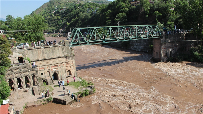
In Muzaffarabad, capital of Pakistan-administered Kashmir, the River Jhelum’s flow spiked to 47,000 cusecs on Saturday, prompting panic.
“A rise in the water level in River Jhelum at Muzaffarabad was recorded, leaving residents panicked. They thought it was a flash flood released by India upstream,” Dawn newspaper quoted a local resident as saying. “People kept watching the river, trying to check if any debris had come, like it does during flood seasons, but they couldn’t find anything.”
Akhtar Mahmood, deputy director of Pakistan’s Flood Forecasting Division, dismissed flooding fears.
“Typically, these days we see up to 50,000 cusecs in River Jhelum. As of now (April 26), we have 47,000 cusecs, which doesn’t even qualify as a low flood in the river,” Mahmood said. “A low flood in River Jhelum ranges between 75,000 and 110,000 cusecs.”
Mahmood said water levels in all rivers typically rise during the current months of every year due to snowmelt and rainfall in the catchment areas. “The water level in River Jhelum at Manga always rises this time of year (until June 15) due to snowmelt, followed by monsoon rains. Similarly, water rising in the Indus at Tarbela is 80 per cent due to snowmelt,” he said.
“At times, the rise in Jhelum’s water level could also be due to the cleaning of a mini-reservoir at the Kishanganga run-of-the-river hydroelectric project. But I believe this rise is due to increased temperatures melting snow.”
Local authorities in Muzaffarabad reported that the river’s flow spiked from 18 cubic meters per second to 26.4 cubic meters per second at 12:15 p.m. on Saturday, before falling to 22 cubic meters per second within an hour. The flood wave passed through the territorial limits of Muzaffarabad without causing any loss or damage.
“Due to India releasing more water than usual into the Jhelum River, there is moderate flooding,” a spokesperson of the Azad Kashmir government said in a statement on Saturday.
The spokesperson urged residents to avoid visiting areas near the Jhelum river due to the rising water levels.
The Indus River System Authority recorded 129,400 cusecs of water inflow and 118,500 cusecs outflow across rim stations on Saturday. At Tarbela Dam on the River Indus, the water level was 1,431.43 feet, with 39,100 cusecs inflow and 43,300 cusecs outflow. At Mangla Dam on the River Jhelum, the level was 1,129.60 feet, with 47,100 cusecs inflow and 32,000 cusecs outflow. Downstream releases included 62,700 cusecs at Kalabagh, 44,300 cusecs at Taunsa, 34,800 cusecs at Guddu, and 7,400 cusecs at Sukkur.
The Indus system, stretching over 3,000 kilometers, sustains 300 million people across both countries. Pakistan’s plains depend on it for wheat and rice, while India’s Punjab thrives on the eastern rivers. Disputes have simmered since 1947’s partition, but the treaty, signed in 1960 after years of talks, offered a rare framework for cooperation—until now.
The World Bank, which still oversees the treaty, has stayed silent on India’s move, though diplomats note it lacks a clause for unilateral exit.
Copyright © 2021 Independent Pakistan | All rights reserved