By Staff Reporter
ISLAMABAD: Pakistan’s weather authorities have warned of heavy to very heavy rainfall across Punjab, Sindh and Balochistan over the coming days, with forecasters cautioning that the River Chenab could reach a high flood level as a fresh monsoon system moves in from India.
The Flood Forecasting Division of the Pakistan Meteorological Department said on Saturday that the wet spell, expected to persist until 4 August, was being driven by a well-marked low-pressure system over southeast Rajasthan combined with strong monsoon currents. Forecasters said the system would bring a widespread spell of rain to central and eastern Punjab, as well as parts of Sindh and Balochistan, and was likely to swell water flows significantly in the eastern rivers — the Sutlej, Ravi and Beas — along with their major tributaries.
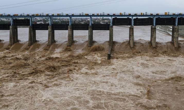
Water levels in the Chenab at Head Marala, Khanki and Qadirabad are expected to climb into the low-to-medium flood range during the forecast period, though officials cautioned that unusually high inflows could push the river beyond that threshold to a high flood level at Marala.
The Provincial Disaster Management Authority said it was monitoring river flows, dams and barrages across Punjab around the clock. It confirmed that low-level flooding was already under way on the Indus at Kalabagh and Chashma, and warned that the current weather system was expected to continue into 5 August — a day longer than the rainfall forecast itself, suggesting river levels may keep rising even after the rain eases.
Flash flood risk in hill torrents
Forecasters also raised the alarm over possible flash flooding in the hill torrents of Dera Ghazi Khan, in streams flowing down from Khyber Pakhtunkhwa and northern Balochistan, and in other catchment areas considered vulnerable to sudden surges.
Urban flooding is a further concern, with the Flood Forecasting Division naming a string of Punjab cities at risk from the intense rainfall: Rawalpindi, Jhelum, Gujranwala, Sargodha, Mandi Bahauddin, Sialkot, Gujrat, Narowal, Lahore, Okara, Sahiwal and Faisalabad.
Tributary streams are expected to swell as well. The division said flows would rise in the Dora, Dota, Dwara, Bhimber and Halsi nullahs, which feed into the Jhelum; in the Aik and Palkhu nullahs, which run into the Chenab; and in the Bein, Basantar, Deg and Sukki nullahs, which drain into the Ravi.
Current river levels
Assessing the present hydrological picture, the Flood Forecasting Division said the Indus was already flowing at low flood levels at Kalabagh, Chashma, Guddu and Sukkur, while the Ravi, Chenab, Jhelum and Sutlej remained below the low flood threshold for now. The Indus at Sukkur is expected to stay within the low flood category at its upstream section over the next 24 hours.
Over that same period, forecasters expect widespread rain, wind and thunderstorms across the region, with isolated heavy to very heavy falls in parts of Punjab, Sindh and Balochistan. Scattered rain and thunderstorms, with isolated heavy falls, are also forecast over the upper catchments of the country’s major rivers, as well as over Islamabad, Azad Jammu and Kashmir and Khyber Pakhtunkhwa.
Rawalpindi hit hardest so far
The disaster management authority said Punjab had already seen widespread rainfall in the 24 hours to Saturday. Rawalpindi bore the brunt, recording 95 millimetres, followed by Murree with 85mm and Jauharabad with 56mm. Multan received 37mm, Bhakkar 31mm, and Narowal and Noorpur Thal 27mm apiece. Khanewal recorded 21mm, Chakwal 20mm, Gujranwala 12mm, Jhang 10mm and Sargodha 8mm.
With more rain on the way, the authority renewed its safety advisory to the public, urging parents in particular to keep children away from rainwater drains, low-lying areas, rivers and canals as the wet spell continues, in order to prevent accidents.
Copyright © 2021 Independent Pakistan | All rights reserved