
By Staff Reporter
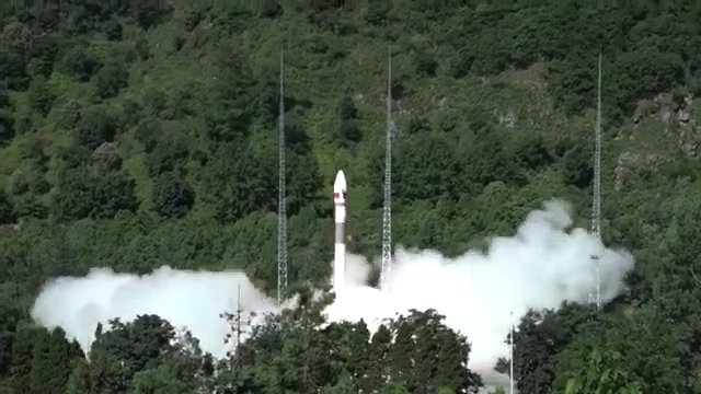
ISLAMABAD: Pakistan successfully launched its Remote Sensing Satellite-1 (PRSS-1) from China’s Xichang Satellite Launch Center on Thursday, a breakthrough that marks a major stride in the country’s space exploration ambitions and deepens its technological partnership with China.
The satellite, hoisted into space aboard a Kuaizhou-1A carrier rocket at 10 a.m. (GMT+8), has entered its preset orbit, Planning Minister Ahsan Iqbal confirmed. The launch, announced by Pakistan’s Space and Upper Atmosphere Research Commission (Suparco), is being hailed as a pivotal moment for the nation’s efforts to enhance its Earth observation capabilities. The PRSS-1 promises to transform how Pakistan tackles some of its most pressing challenges.
According to Suparco, the satellite’s imaging capabilities will revolutionize urban planning, disaster management, food security, and environmental protection. It will also play a critical role in monitoring climate change, managing water resources, mapping agricultural patterns, and tracking deforestation.
The launch stems from a collaboration between Suparco, China Electronics Technology Group Corporation, and MICROSAT China, reflecting years of joint work to bring the project to fruition.
The satellite’s advanced technology will support precision agriculture to boost crop yields, monitor infrastructure growth, and enable more effective regional planning. In disaster management, it will provide timely warnings for floods, landslides, and earthquakes, while keeping tabs on environmental shifts like glacier recession.
“This is not only a technological milestone but a moment that lifts our national spirit and elevates our friendship with China,” Planning Minister Ahsan Iqbal said at the launch ceremony. His remarks underscored the strategic weight of the project, which is expected to bolster initiatives like the China-Pakistan Economic Corridor (CPEC) by mapping transportation networks and identifying geohazard risks.
Suparco Chairman Muhammad Yousaf Khan emphasized the satellite’s broad impact. “The Remote Sensing Satellite will support national priorities across multiple sectors and will contribute towards sustainable socio-economic development,” he said.
From agriculture to urban expansion, the satellite’s data will provide a foundation for smarter, more resilient growth. The achievement has sparked widespread pride in Pakistan. President Asif Ali Zardari congratulated the country’s scientists, saying, “Pakistan is proud of the capabilities of its scientists.” In a post on X, Prime Minister Shehbaz Sharif echoed that sentiment, praising Suparco’s success and thanking China for its partnership. “This milestone reflects the strength of our collaboration,” he wrote. The Chinese embassy in Pakistan also extended congratulations.
Copyright © 2021 Independent Pakistan | All rights reserved